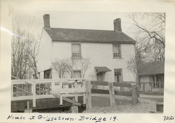
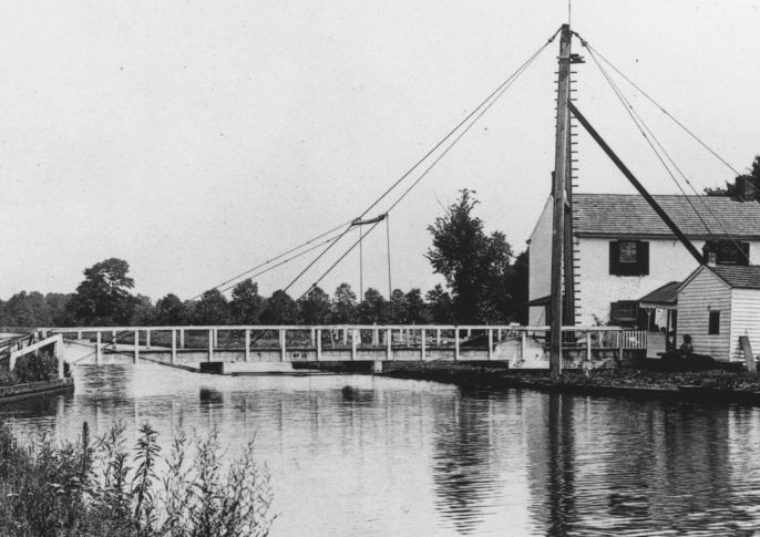
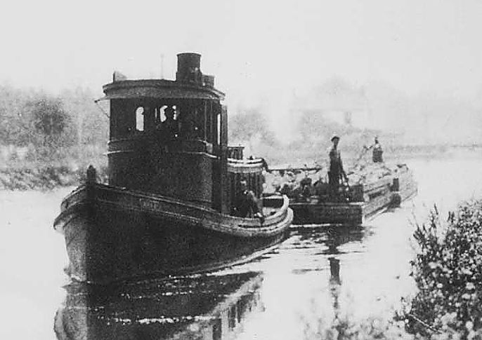
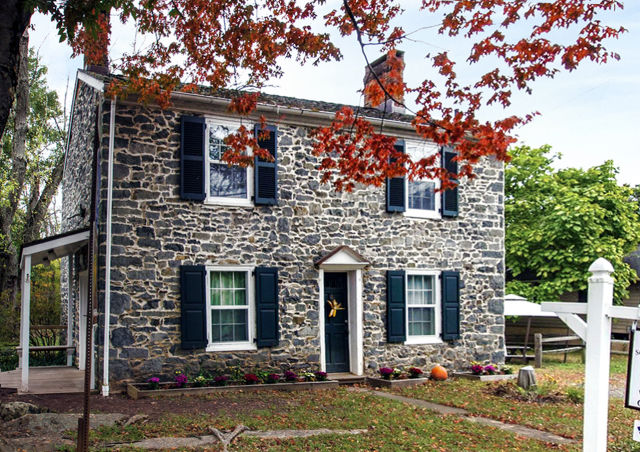
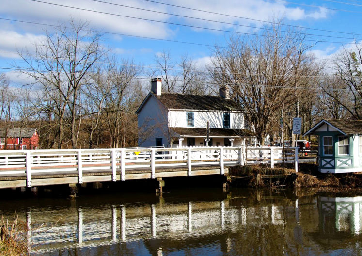
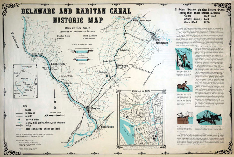
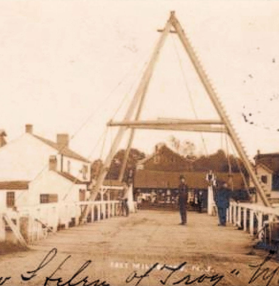
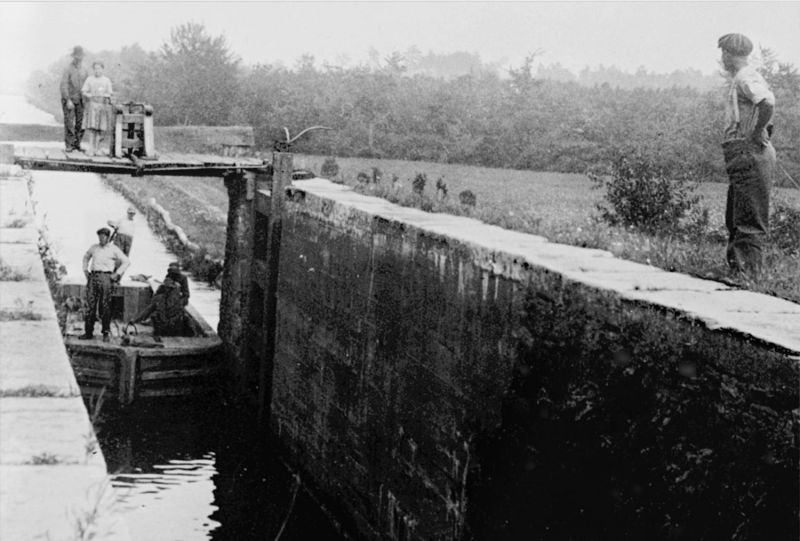
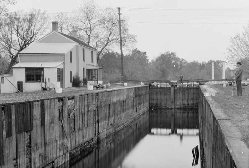
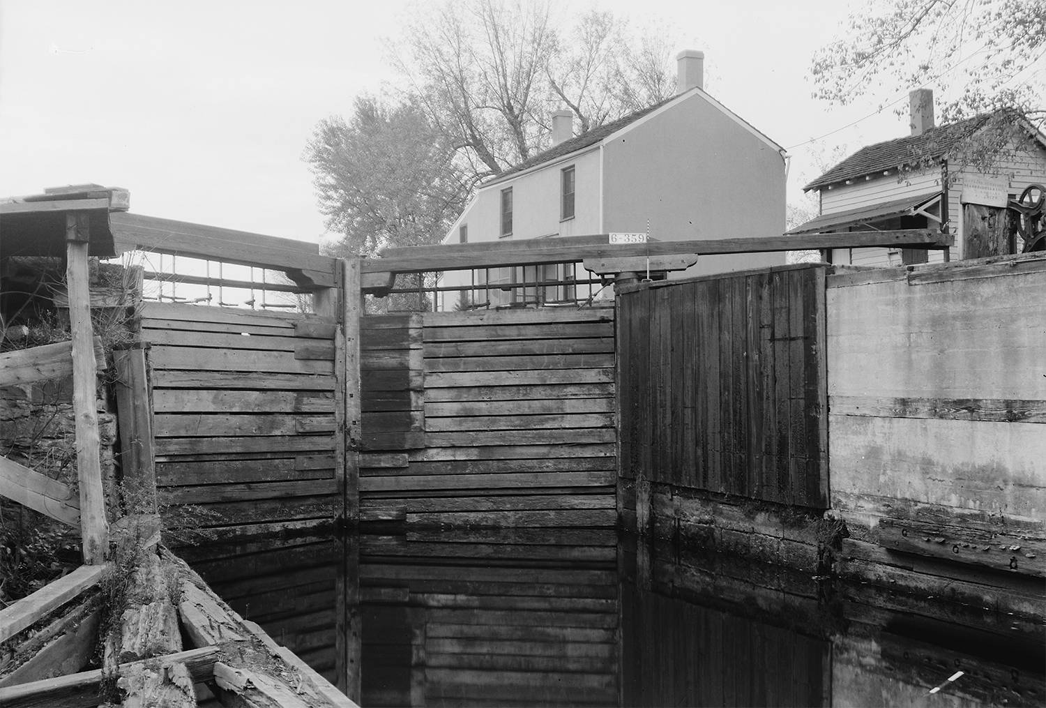
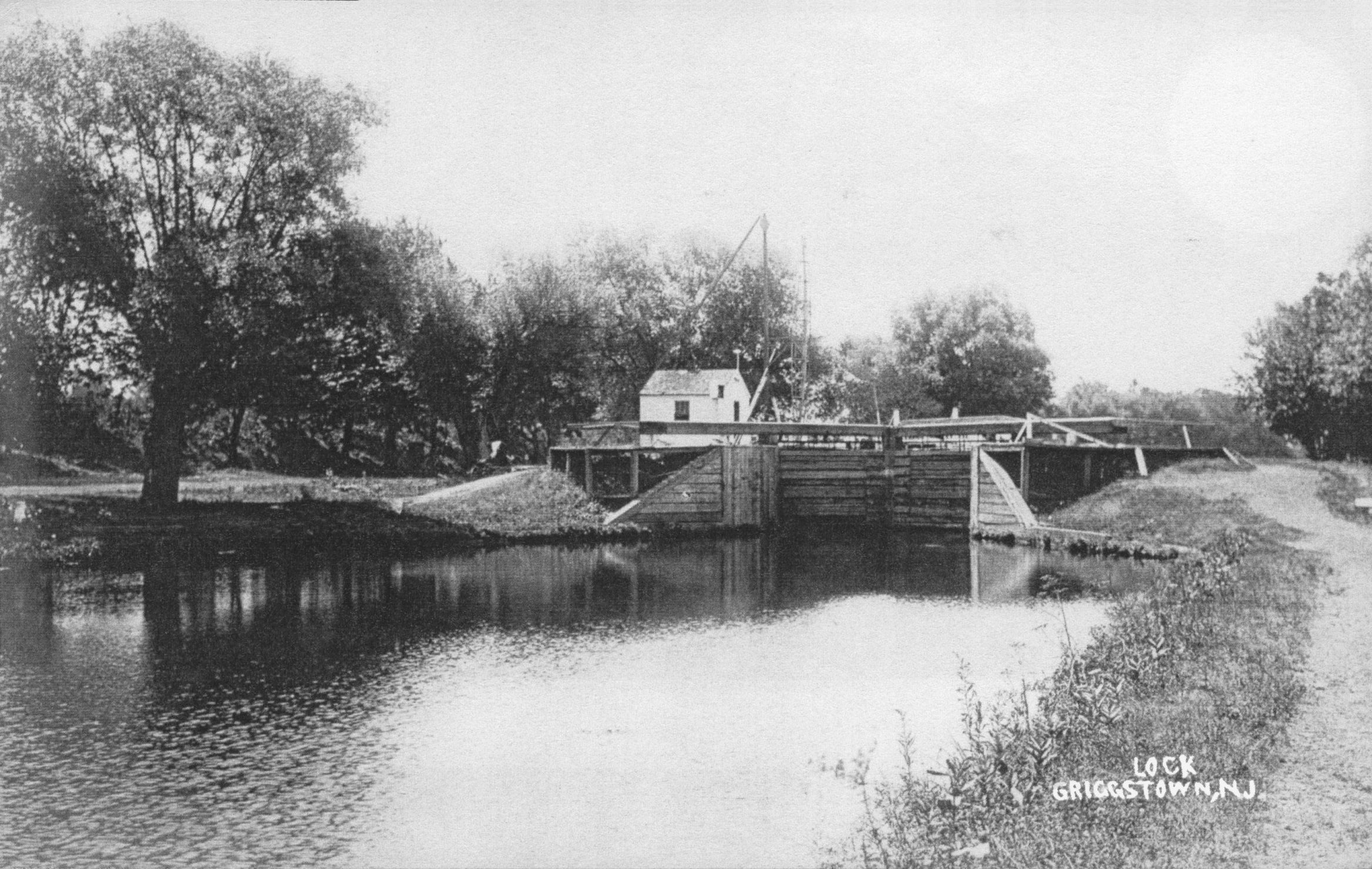
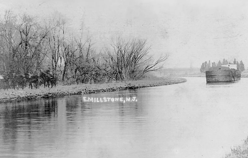
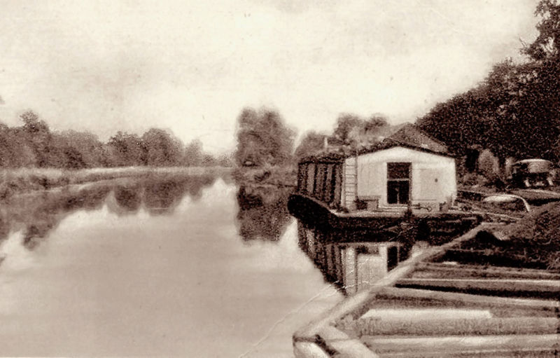
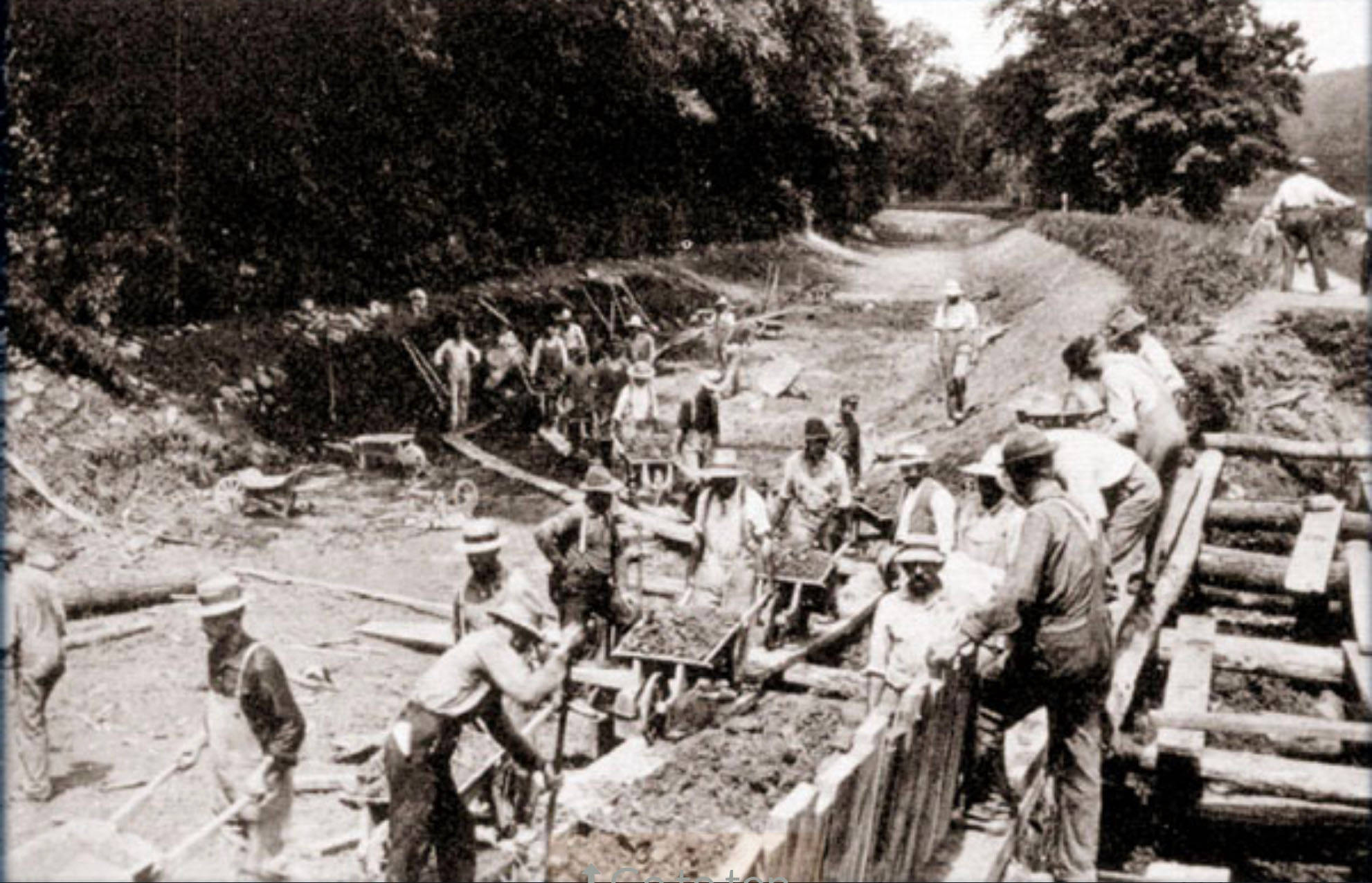
Canal Era
The Delaware and Raritan Canal - Then and Now   

The Canal Era

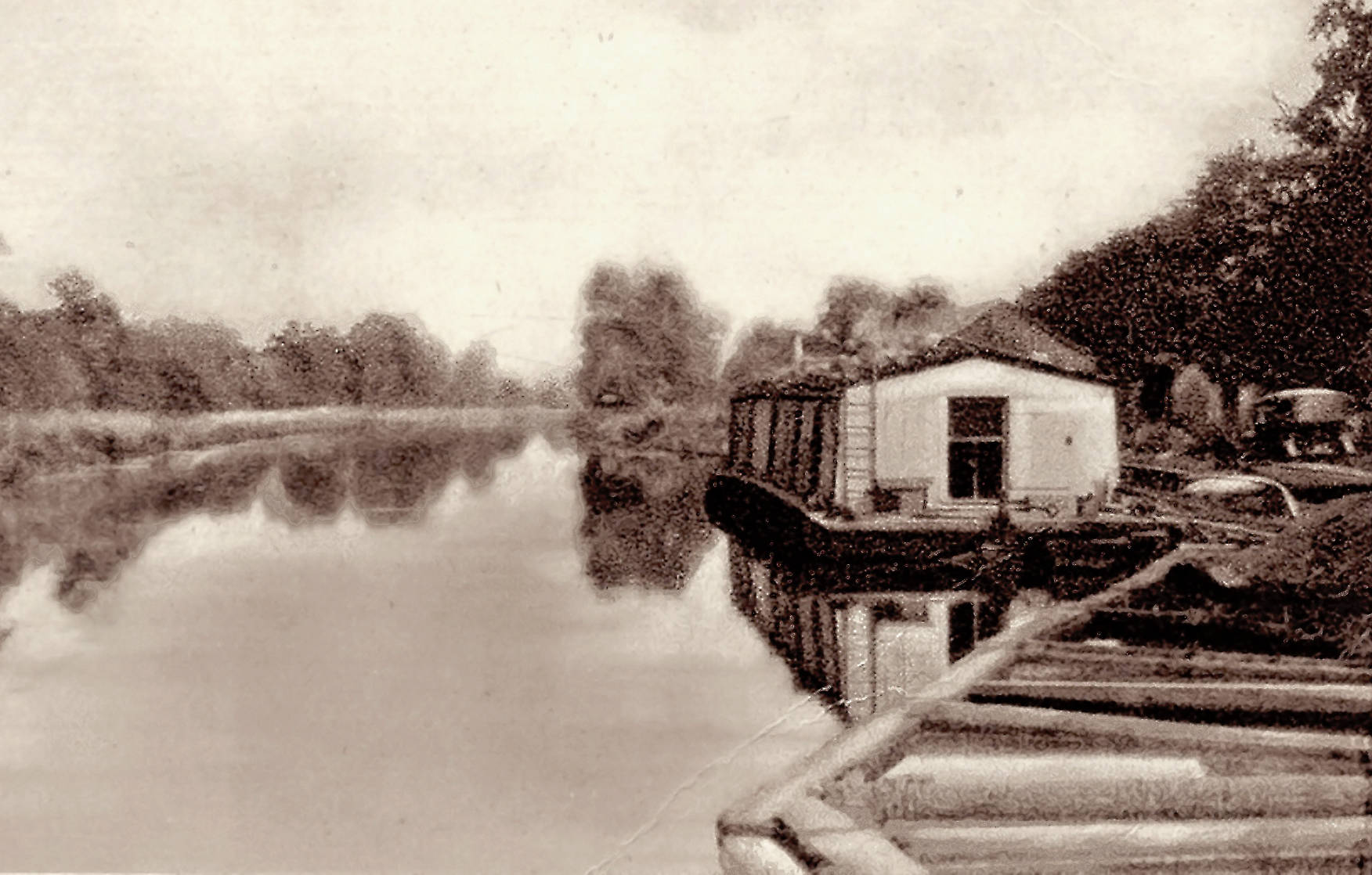
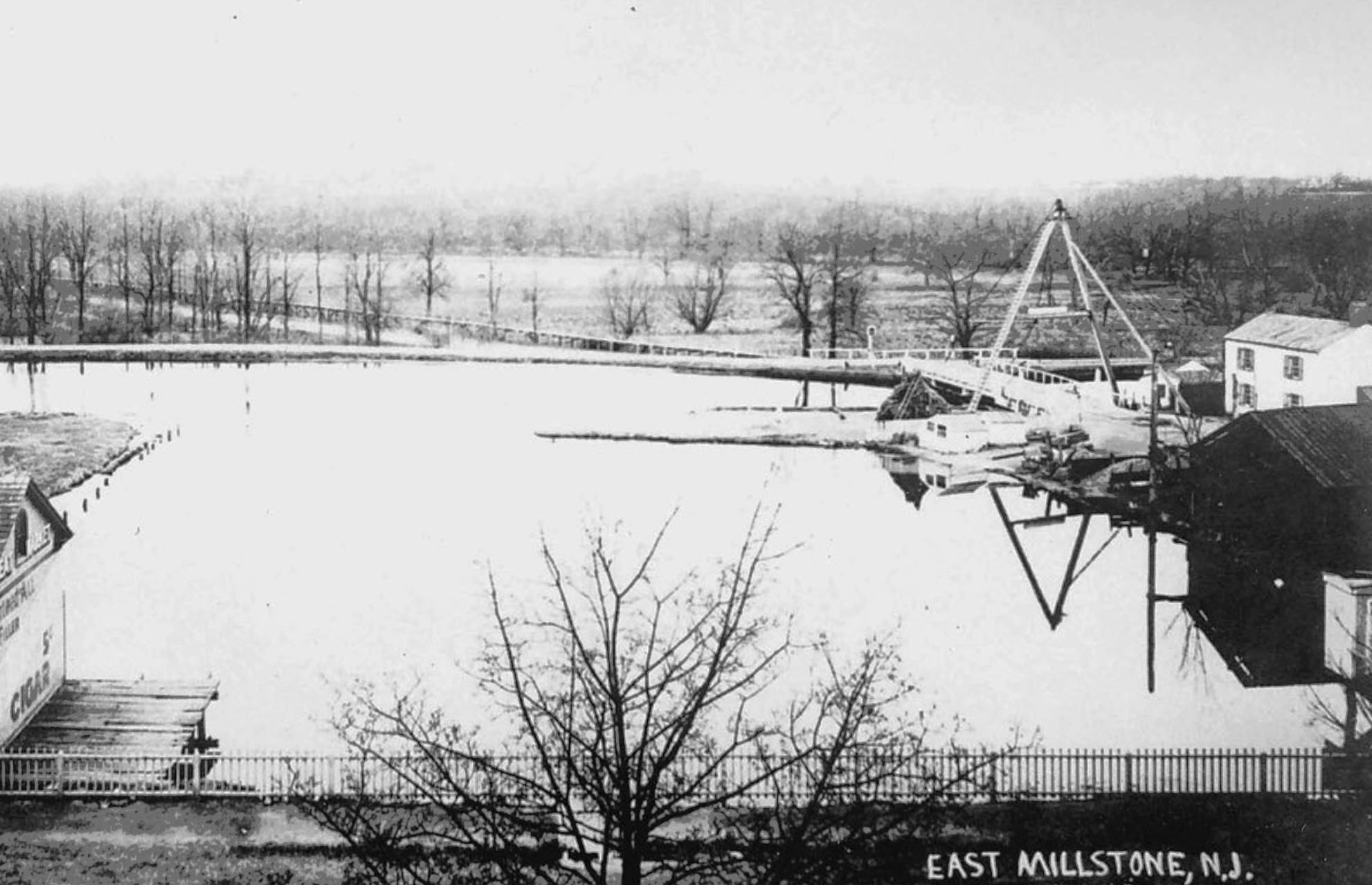
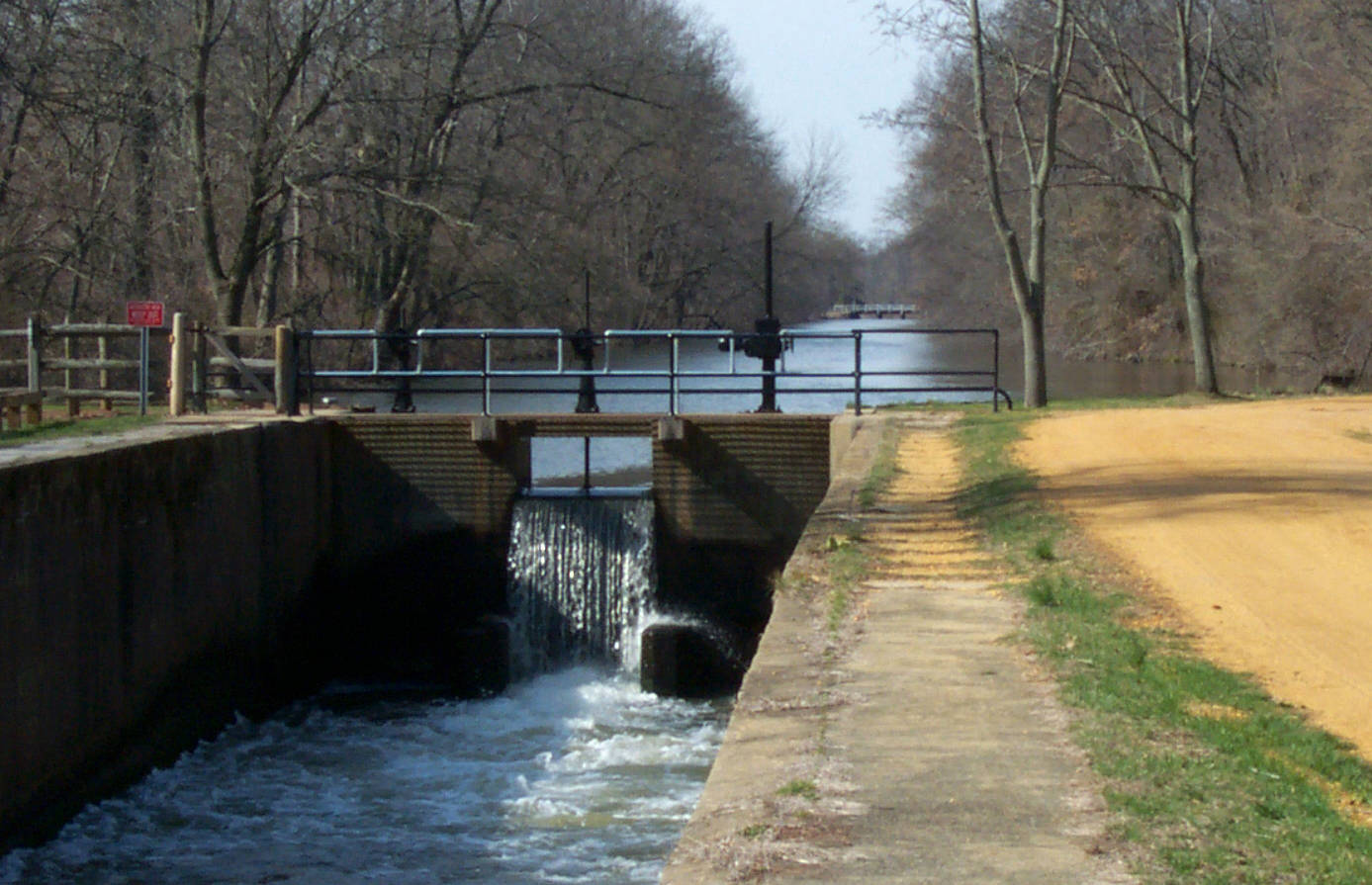
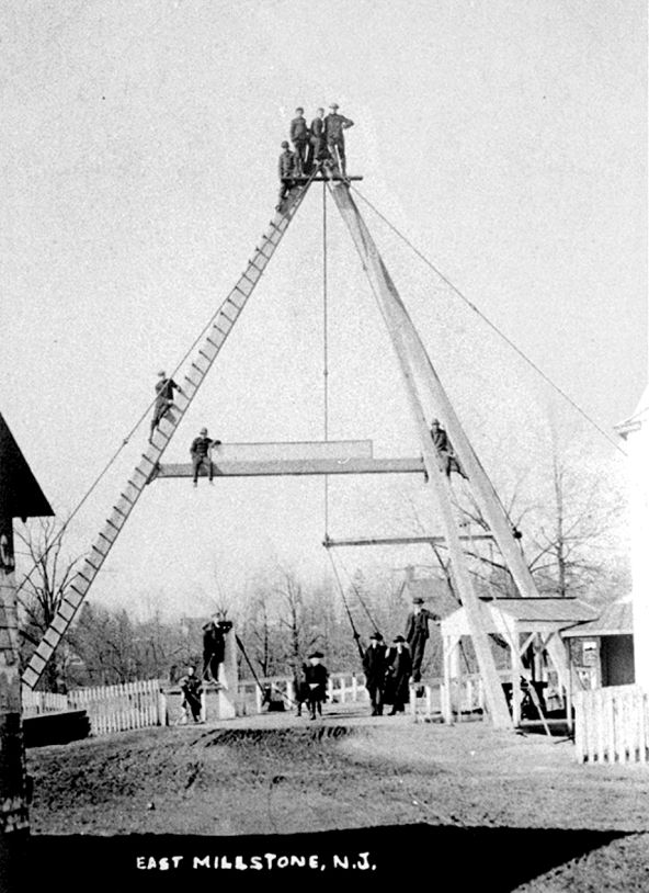
When the Erie Canal opened in 1825, it proved to be a bonanza for New York State's economic development. Until then, the country had relied on roads and rivers for transportation. When it became clear that a team of mules, walking along a canal towpath towing a boat, could draw heavier loads and work for longer hours than horses working on the turnpike, the rush to build canals was on. New Jersey decided to follow New York's example, and soon the D&R Canal was built. It was one of seven "anthracite canals" built in the northeast with the goal of shipping coal from the coalfields of Pennsylvania to the ever-growing cities near the coast. In addition to coal, the canal boats also carried agricultural products and manufactured goods both from the cities and outlying areas. For many years it acted a a stimulus to all forms of growth in its path. For almost 100 years the D&R Canal was one of America's busiest waterways, in one year carrying more tonnage than the more famous Erie Canal. The result of this success can be seen in the villages and farms along the canal in the Millstone River Valley, where towns grew larger and more prosperous. In some places there are houses built during the latter part of the 19th century and identified as "Canal Era" houses in their style of architecture.

The Canal Route from the Delaware River to the Raritan River


The D&R Canal was built in 2 sections. The feeder canal was 22 miles long. It started at Bull's Island on the Delaware River and was 6 feet deep and 50 feet wide. Water entered the feeder at an elevation of 58 feet above sea level and flowed south beside the Delaware River to Trenton, where it met and supplied water to the main canal. The 44-mile-long main canal, at 75 feet wide and 8 feet deep, was wider and deeper than the feeder canal and carried a large variety of boats. It began at Lock 1 at Bordentown. Flowing north through seven locks, the canal reached fifty-eight feet above sea level at Trenton, the highest point of the main canal. The canal then turned northeast, gradually descending through the Millstone River Valley and exiting at sea level into the Raritan River at New Brunswick. Nearly 36 miles of the main canal and 22 miles of the feeder canal still exist, although the locks are no longer operational.

Building the D&R Canal

Building the canal required a huge effort, removing dirt, rocks, debris, and plants, digging a "Big Ditch" 44 miles long, 75 feet across, and 8 feet deep. Much of the work was done by Irish immigrant laborers, but many local farmers took advantage of the $1 a day wage, and joined in. The canal was dug by hand with shovels, pickaxes, and wheelbarrows. Some men removed tree stumps, receiving an additional 25 cents for each stump. More skilled men, carpenters, and stonemasons built the locks, bridges, aqueduct, and buildings needed for canal operation. They earned more money than the unskilled workers. An outbreak of cholera in 1832 spread rapidly among the workers, killing many workers.

Canal Infrastructure: Bridges, Locks, and Houses

Locks and moveable bridges were a necessary part of the D&R Canal. Locks were needed to move vessels from one level of the canal to another. Moveable bridges, when opened, allowed boats to pass and when closed, allowed road traffic to pass over the waterway. A large labor force was required to operate the locks and bridges and to keep the whole system in good repair. The canal company built homes at the bridges and locks to house many of these canal workers. Each house was occupied by a canal company employee and family whose task was to operate the adjacent bridge or lock. Eighteen of the sixty-six original canal houses remain standing today.
     
The canal originally had 14 locks to raise and lower boat traffic. The locks were operated by steam-powered winches and valves after 1868.

The canal’s early bridges were A-framed "swing bridges" that pivoted horizontally, allowing vessels of any height to pass. A wooden framework shaped like the letter "A" supported the bridge with a network of cables. The swing bridges rotated on a pivot and usually operated from the bank of the canal to the towpath on the opposite side. The pivot allowed the bridge to move to the side. The photograph at the right shows the A-frame swing bridge in East Millstone with the bridge tender's house at left. 

Canal A-Frame Bridges

Moveable Bridges on the D&R Canal

The images above, illustrating the action of the A-frame bridges, are taken from a video about the D&R Canal bridges made by Vicki Chirco, Historic Preservation Specialist of the D&R Canal State Park. The video can be seen on the Bridges page on the D&R Canal State Park website.

Click here to access the Bridges page on the D&R Canal State Park website sponsored by D&R Canal Watch.

Canal Locks

How a Lock Works – Moving vessels from one level of the canal to another

Going Downstream

1. If the lock is empty, the lower miter gates are closed. The lock is then filled with water by opening the wickets (rotating valves) in the bottom section of the upper gates.
2. When the lock is full, the upper miter gates are opened, and the canal boat enters.
3. The wickets in the upper gates are shut, and the upper miter gates are fully closed.
4. The wickets in the lower gate are opened, and the level of the water in the lock is dropped until it is the same as the water level below the lock.
5. When the water levels match, the lower miter gates are opened, and the canal boat is pulled out of the lock and continues on its downstream journey.  

Going Upstream

1. If the lock is full, the wickets (rotating valves) in the bottom section of the lower miter gates are opened, and the water level in the lock is dropped until it is the same as the water level below the lock.
2. When the water levels match, the lower miter gates are opened, and the boat is pulled into the lock.
3. The wickets in the lower miter gates are shut, and the lower miter gates are fully closed.
4. The wickets in the upper miter gates are opened, and the lock is filled until the water level in the lock is the same as the water level above the lock.
5. When the water levels match, the upper miter gates are opened, and the canal boat is pulled out of the lock and continues on its upstream journey. 


The description of how a canal lock works and the accompanying animation are shown with permission of the Friends of the Delaware Canal. The Delaware Canal and the D&R Canal have a historic connection. In the 1840s, an outlet lock into the Delaware River was constructed to permit vessels from the Delaware Canal access to the D&R Canal’s feeder canal at Lambertville. The cross-river connection allowed Pennsylvania coal to be carried directly to markets in New Jersey and New York. The Friends of the Delaware Canal website has extensive information about the Delaware Canal and informative pages about canal locks and canal mules. Click here to visit the Friends of the Delaware Canal website .

Historic Background of the Delaware & Raritan Canal

By Gordon Perry

The importance of a transportation route through the central region of New Jersey to link Philadelphia and New York City was recognized by William Penn long before the American Revolution.  The conclusion reached by a study commissioned during the presidency of Thomas Jefferson in 1807 indicated that a system of roads and canals would provide for the safe passage of goods and facilitate commerce.  The study also indicated that the development of an inland navigation system extending from Massachusetts to Georgia would be an important asset for the developing country. Although nothing was accomplished on the federal level, several attempts were made by a number of New Jersey canal supporters, but necessary funds were lacking.  Finally, on February 4, 1830, the Delaware & Raritan Canal Company was incorporated by the state legislature with the provision that 5,000 shares of stock would be sold within one year and that the company charter would be withdrawn if the stock was not sold within that time period.  Since early stock sales were very disappointing, Robert Stockton of Princeton sought financial support for the canal building project from his father-in-law, John Porter, who was a wealthy Charleston plantation owner.  Porter purchased the shares necessary for the company charter to remain in effect.

Canal construction began in 1830 under the direction of Chief Engineer Canvass White who gained much experience in building the Erie, Union, Lehigh, and several other canals.  The main canal was hand dug and lined with clay by immigrant and local laborers and extended a total of 44 miles from a southern terminus at Bordentown, on the Delaware River, to its high point of 58 feet at Trenton.  The canal then travelled northeastward to tidewater at its northern terminus of New Brunswick on the Raritan River.  Since the elevation change on the main canal was only 115 feet, few locks were needed.  Locks were numbered beginning at Bordentown with a total of 7 locks located between Bordentown and Trenton, and 7 additional locks between Trenton and New Brunswick.  Since the canal became part of the Intracoastal Waterway, which provided passage between the Chesapeake Bay and New England, improvements were made to accommodate larger sailing vessels.  The main canal was 75 ft. wide and gradually deepened from 6 to 8 feet in 1851.  Lock chambers were 24 ft. in width and originally 110 feet long, but increased to 220 feet after 1853.  The canal also had several aqueducts, banks covered with stone, swing bridges to allow large vessels to pass through, and an operating telegraph system over its entire length to communicate changes in water level, breaks in the canal, problems with the towpath, and to report any boat that violated the 4 mph speed limit.  Mules were primarily employed to move boats through the canal but steam-powered vessels were introduced in 1843.

Water for the main canal was supplied from the Delaware River by way of a 22-mile feeder constructed parallel to the river southward to Trenton and measuring 60 ft. in width at the surface and 6 ft. in depth.  The feeder had only 3 locks over its entire length.  A wing dam and guard lock, with no lift, was constructed about two miles north of Stockton at Bull’s Island to divert water from the river.  A second guard lock, with no lift, was located at Prallsville to prevent flooding from the Wickecheoke Creek.  In the summer of 1848, an outlet lock was opened at Lambertville to allow canal boats loaded with coal from the Delaware Division Canal in Pennsylvania to enter the D&R Canal and deliver coal to eastern markets.  The feeder canal was completed under the direction of Ashbel Welsh, who succeeded Canvass White as chief engineer.  Vessels travelled northward on the feeder as far as Brookville, a site south of Stockton, and the last manufacturing center and former location of Deats Industries, a producer of stoves, farm plows, and other farm machinery from 1852 to 1881.

In 1831, The Delaware & Raritan Canal Company and the Camden & Amboy Railroad Company merged to eliminate competition between the canal and railroad.  In 1871, the Pennsylvania Railroad Company leased the canal for 999 years and, after many years of financial losses, ceased operating the canal in 1933.  The D&R charter specified that a state takeover would occur if the canal failed to operate for a period of three consecutive years.  Accordingly, the Trenton portion of the canal was deeded to the city and filled in, while the canal south of Trenton was abandoned.  The remainder of the canal was turned over to the state of New Jersey in 1937. The main canal and feeder were converted to a water supply system and rehabilitation began in 1944 with the replacement of locks with dams to control water flow.  The New Jersey Water Supply Authority currently operates and maintains the canal as a water resource.  In 1973, the D&R Canal was placed on the National Register of Historic Places and officially designated as the Delaware & Raritan State Park in 1974. 


Click here to learn more about the history of the D&R Canal on the D&R Canal State Park website, sponsored by D&R Canal Watch

Scenes along the Canal: 1834 to 2021

Scroll over the photos for captions

Below: East Millstone Children by the D&R Canal in the 1940s

© Copyright 2024 Millstone Valley Preservation Coalition